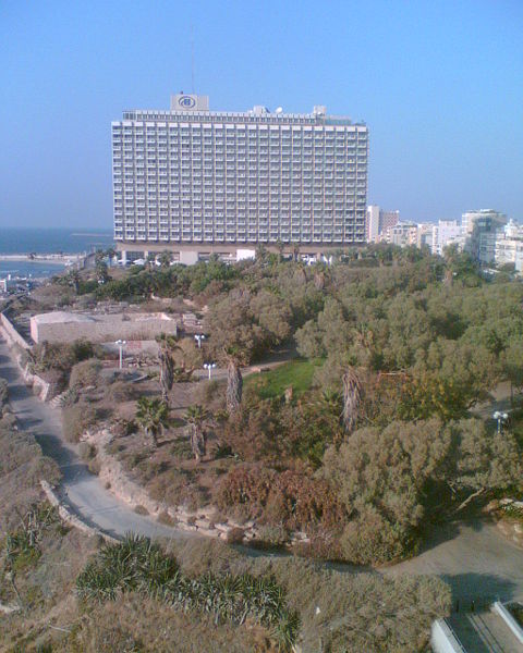
1. Ridge,
Ajami Neighborhood
-
During the 19th
century, the population of Yafo swelled and new neighborhoods were built
outside the walls of the ancient city. The Ajami neighborhood, Saknet al-'Ajami, is named after Sheikh
Ibrahim al-'Ajami who, according to tradition, is buried in a local mosque.
This area, which had been populated by impoverished Egyptian immigrants, was
later inhabited by affluent Christians. The surrounding neighborhood along Yefet St. (Gaza Road) is
distinguished by many architectural treasures and important historical sites.
The seashore at the foot of the ridge – the Yafo Ridge – was an important
vacation spot for local Arab residents and British Mandate officials. The area,
which deteriorated over the years and was used as a garbage dump, is currently
undergoing a wave of renovation and development.
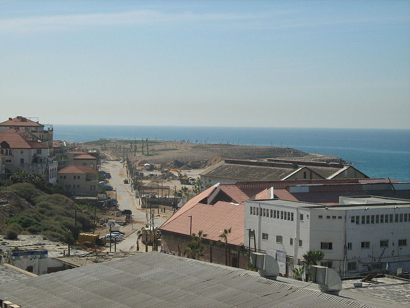
Picture Credit: Ori. License: CC-BY-SA-1.0,2.0,2.5,3.0
2. Yafo Port
The Yafo
seaport is one of the oldest in the world. It is a natural shallow water harbor
used to load and unload rigs, while the ships themselves were anchored at a
distance from the coastline. The Mandate government improved the port and built
the breakwater and the quay that are still in use today. Until the opening of the
Haifa port in
1933, the Yafo port was the principal commercial port for the export of citrus
fruit. The Jews termed the port “Gateway to Zion,” because it was the principle entry for
new immigrants from the 1880s onwards. In 1965, with the opening of the Ashdod port, the Yafo
port ceased its commercial operations. In the sea, at the entrance to the
marina, is Andromeda's rock. According
to Greek mythology, Andromeda was punished by Poseidon, the God of the Sea, and
chained to this rock. Above us is the renovated Old City of Yafo that has
become a magnet for artists.
3.
Clock
Square, The Saray -The Clock Square was
the central plaza in Yafo; surrounding it are government buildings and the
commercial center and markets built after the dismantling of the ancient city
walls in the 19th century. The square was also an important
crossroads, from which the routes leading to Gaza,
Jerusalem and Nablus fanned out. At the center of the
square stands the Clock Tower, whose construction was completed around 1904.
The two clocks at the top of the tower were installed by watchmakers Maurice
Schönberg and Zerach Alter Moshli. The numerals on the clocks, which face north
and south, were inscribed in Arabic-Oriental characters. The restored facade of
the Saray (Turkish for palace) stands to the east of the square. The building,
designed by Baruch Papiermeister, served as government headquarters for both
the Ottoman and British regimes from the end of the 19th century
until the mid1930. On January 4, 1948, the Lehi underground organization blew
up and destroyed the building, killing many local residents.
4. Etzel Museum -
The building
facing us, almost a sole remnant (restored) of the al-Manshiyeh quarter of
Yafo, houses the Etzel
Museum. The al-Manshiyeh
quarter, north of Boustrus (Raziel) St., was
founded in the second half of the 19th century and was populated by Arab migrant workers and
many Jews. The string of poverty-stricken neighborhoods and slums that rapidly
sprang up was known by the collective name al-Manshiyeh. Two of the important institutions that were built in
the neighborhood were the first Jewish hospital in Yafo, Sha’ar Zion, and the
Bella Vista Hotel. On April 28, 1948, Etzel (Irgun) forces captured most of
al-Manshiyeh. In the 1960s, the homes in the quarter were vacated and razed in
order to transform the area into the financial and trade center of the city.
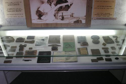
Picture Credit: Wikipedia
5. Yafo
Railroad Station
-The railway
from Yafo to Jerusalem
was inaugurated on September 26, 1892. The journey took four hours. Among its
more celebrated passengers were Kaiser Wilhelm II of Germany
and Benjamin Ze’ev Herzl, when they visited the region Israel in
October 1898. From the time the British army occupied Yafo until the end of the
1920s, a light transit rail, the Jaffa Tramway (Tranzina), linked the port
to the train station. Nearby is the residence and ceramic floor tile factory of
the Wieland family, Templers who settled in Yafo in the mid 19th
century. The compound is now under renovation and will serve as a cultural,
recreational and entertainment center.
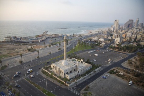
6. Hassan Bek Mosque
- The Hassan
Bek mosque was built at the northern end of the al-Manshiyeh quarter in 1916,
by the military governor of Yafo, Hassan Bey al-Basri al-Ghabi. In 1983 the
minaret of the mosque collapsed. During its renovation, the area of the mosque
was vastly expanded and a new minaret, twice as high as the original, was
erected.
7. Historical boundary between Yafo and Tel Aviv
- We are
standing opposite Daniel St.,
which marked the border between Yafo and Tel Aviv until 1948. Following the
Arab revolt in May 1921, the Mandate government granted the neighborhood of Tel
Aviv the status of a township in the city of Yafo. The Neve Zedek and Neve Shalom
neighborhoods merged with Tel Aviv, and additional territory was annexed as
well. During the Arab Revolt of 1936-1939, the government approved the
annexation of the Shapira and Florentine neighborhoods to Tel Aviv. With the
outbreak of the War of Independence, a security border between the two cities
was set - one which essentially conformed to the partition plan - in which all the Jewish neighborhoods of
Yafo were incorporated into Tel Aviv.
8. Knesset Square
, Opera House
-
After the
First World War, Tel Aviv began to expand and build along the length of Allenby St. The
need to link up with the land that had been acquired for building and
development along the sea, and to create a hub of entertainment and leisure
activity, led to the routing of Allenby
St. westward as well. Architect Richard Kaufmann
proposed ending the street in a fan-shaped square and in 1921, Joseph Neufeld
proposed merging the porticos of the buildings surrounding the square to form
an arcade. The seaside promenade extended northwards from the square; facing
it, the café-restaurant Galei Aviv (also known as the Casino) was built in 1922. In 1945, the Kessem
cinema was built in the square. In 1948, prior to the elections to the
Constituent Assembly/the First Knesset (parliament), the cinema building and
the adjacent San Remo Hotel were requisitioned, and the auditorium served as the
plenary of the Knesset until December 1949. In 1958, the site was inaugurated as the
home of the Israel National Opera, under the aegis of Edis de Phillipe, which
operated at this location until 1982.
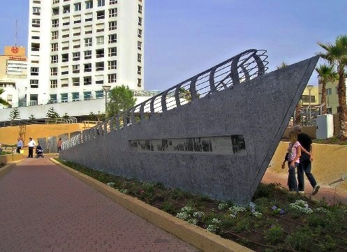
9. London
Square -
London Square was inaugurated on May 24, 1942,
British Empire Day. The square was built as part of the plan by city engineer
Yaacov Shifman to improve Tel Aviv’s seashore and promenade, and the park was
designed and planted by landscape architect Abraham Karavan. The square is
named for the city of London,
as a tribute to the steadfast resistance of Londoners during WWII. Nearby, to
the north of the square, on June 22, 1948, the Etzel (Irgun) ship Altalena was
beached while carrying immigrants, in addition to arms and ammunition that were
meant, according to prior agreement, to be divided between the IDF and the
Etzel (Irgun). In a controversial decision, Prime Minister David Ben Gurion
ordered the shelling of the ship, which went up in flames. The park was
recently renovated and now commemorates the names of all the ships that
transported immigrants to Eretz Israel,
among them the Parita and the Tiger Hill, which reached the coastline of Tel
Aviv on the eve of WWII. On the wall of
the Gordon Beach promenade, there is an audio explanation commemorating Abie
Nathan's Voice of Peace ship.
10. Mahloul Neighborhood
- Mahloul land
means uncultivated land that is owned by the government. In the 1920s, the Tel
Aviv city council permitted new immigrants and refugees from the 1921 Yafo
disturbances to put up temporary living quarters, mostly makeshift shacks which
eventually became permanent, along the Mahloul seashore. The neighborhood
stretched from Gordon St.
on the south to north of Ben Gurion (Keren Kayemet) Blvd.; at its peak, it
numbered several hundred shacks. There were two factories in the neighborhood -
Delphiner-Yochananof, which manufactured silk fabrics, and Levkowitz Bros.,
which processed leather hides – in whose cellar the Haganah set up an arms
factory. In the 1950s and 1960s, the neighborhood was razed, and in its place
the Atarim square, designed by Yaacov Rechter was built.
11. Independence Park
- The site on
which Independence
Park was built had
already been designated in the Geddes plan as a central park on the seashore.
On June 16, 1933, at the foot of the coarse sand ridge along the beach, Chaim
Arlosoroff, the head of the Political Department of the Jewish Agency, was
murdered. The park, which commemorates the rebirth of the State of Israel, was
inaugurated in 1952. It was designed and built by Abraham Karavan. The view of
the sea and the vegetation of the beach were central elements in the design of
the park. The park features a number of sculptures and monuments including a
statue of a bird with a broken wing, dedicated to the memory of two IDF pilots
who fell in the War of Independence while defending Tel Aviv, Aaron David
Shprintzak and Matitiyahu Sukenik; the statue was designed by Benjamin Tamuz
and Aba Elhanani. South of the park, around the tomb of Sheikh Abed al-Nabi,
there was a Muslim cemetery that was moved to Yafo in 1963.
Picture Credit: Michael Ya'akobson
12. Metzitzim Beach
-
The
“Metzitzim” (peeping toms) beach is named after Uri Zohar’s 1972 film,
Metzitzizm, whose plot takes place on this beach. The film, its stars, Uri
Zohar, Arik Einstein and Zvi Shisel, and the beach an autonomous territory cut
off from every day life - have come to symbolize the heyday of the ‘60s.
13. Tel Aviv
Port -The demand of
city leaders to build an independent
seaport in the city was rejected on the justifiable grounds that it was
unnecessary, in view of the plan to build a central deep water harbor in Haifa (inaugurated in
1933). During the Yafo dockworkers’ strike in solidarity with the Arab revolt
in April 1936, the British Government demonstratively approved the construction
of a jetty on the Tel Aviv seashore. A short wooden jetty was immediately built
on a beach south of the Levant Fairgrounds, as a sign of readiness for a Jewish
port. On May 19, the first ship, carrying sacks of cement, was unloaded
opposite the Tel Aviv seashore. Construction of a deep water harbor was beyond
the means of the Tel Aviv municipality and the Jewish Yishuv at the time, so
loading and unloading of ships was done by rigs, as in the Yafo port, at high
sea. During the War of Independence the port played an important role in
bringing provisions to the Yishuv, and breaking the arms embargo that had been
imposed. Local community leaders did not
relinquish the idea of building an additional deep water harbor in their city,
but the government voted to build it in Ashdod.
The port ceased operations in 1965.
14. Levant Fair-
The name
Levant Fair refers to a series of international expositions and trade fairs
held in Tel Aviv in the 1920s and 1930s. During the years 1927-1932, the fairs
were held in the grounds which later became the old central bus station of Tel
Aviv. The success of the fairs led to the allocation of land for the
construction of a permanent compound in the northernmost section of the city,
near the Yarkon estuary and the Maccabiah stadium. The fair officially opened
on April 26, 1934 in
the presence of the High Commissioner, Sir Arthur Wauchope. Thirty nations took
part in the fair, which attracted 600,000 visitors. The entrance square, where
we are now standing, is named Plumer
Square, after the second High Commissioner,
Herbert Plumer. A statue of a flying camel, the fair’s logo, stood atop a
pillar at the main entrance. The sculpture of the Hebrew Laborer, by Arieh
Elhanani still stands in the compound. The following fair, in 1936, was
overshadowed by events of the Arab revolt and was the last one to be held here.
After the founding of the State, new Fair Grounds were built on Rokach Blvd.
15. The Lighthouse
- The hill
where we are standing features a number of sites: the Tel Kudadi mound, a
monument commemorating the crossing of the Yarkon River by the British troops
in December 1917, and a lighthouse. The lighthouse was
erected in 1934-1936, in
order to warn approaching ships that the area was prone to fierce storms during
the winter. During the construction of the Reading Power Station,
archaeological excavations were conducted at the mound. Approaching the hill
from the south, we crossed over the Yarkon via a footbridge built to service
the Power Station. The bridge is (erroneously) known as the Wauchope Bridge.
See more Yourway Tours in Tel Aviv & Jaffa!